Agriculture no longer has
blind spots.

JooL reveals what every hectare hides: risks, anomalies, potential and critical decisions through AI,
satellite intelligence and drones.

satellite_alt NDVI · Live Analysis
check_circle Diagnostics delivered in under 2 hours
satellite_alt
KIRIQ AI
Risks detected, report available
chevron_right
camera
Jool Monitor
Drone map ready
chevron_right
badge
Jool ID
Farmer georeferenced
chevron_right
person
Mon Agro
Agronomist available
chevron_right
badgeAgricultural identity
satellite_altSatellite analytics
analyticsAI reports
grassField operations

Read the real condition
of your fields.

KIRiQ AI transforms satellite imagery into clear field intelligence: anomalies, risk zones, potential yield impact and recommendations.
You decide before losses become visible in the field.

01
Early anomaly detection
Identify weak signals and spot areas to watch before losses become visible.
02
Risk scoring & yield estimation
Measure anomaly severity, estimate yield impact and prioritise the most critical interventions.
03
Portfolio-scale risk monitoring
Compare your plots over time, monitor risk evolution and manage decisions from individual agricultural blocks to entire supply chains.
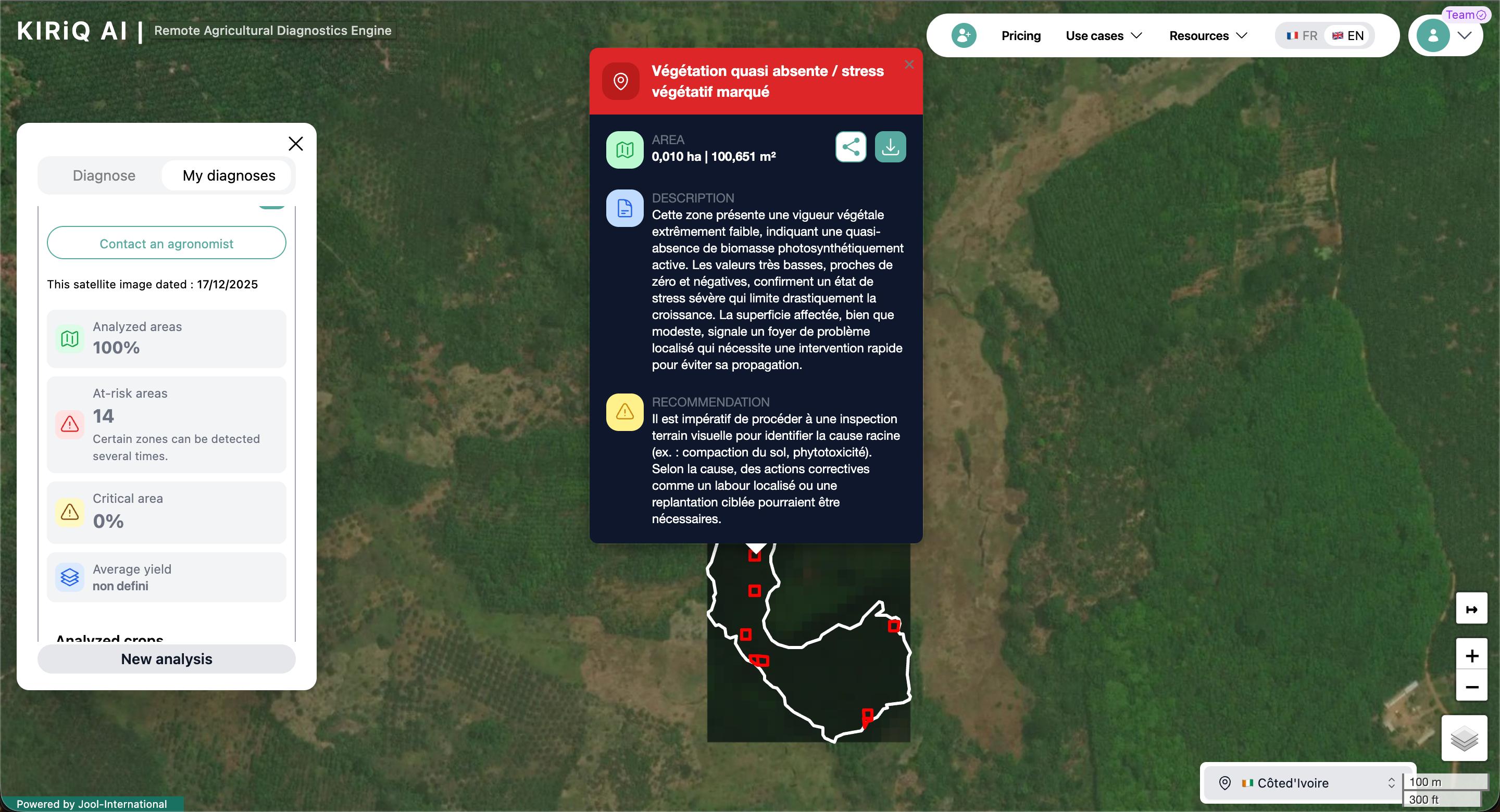
KIRiQ AI — plot analysis
warning 4 anomalies detected
trending_up Estimated yield impact

See your land
in high resolution.

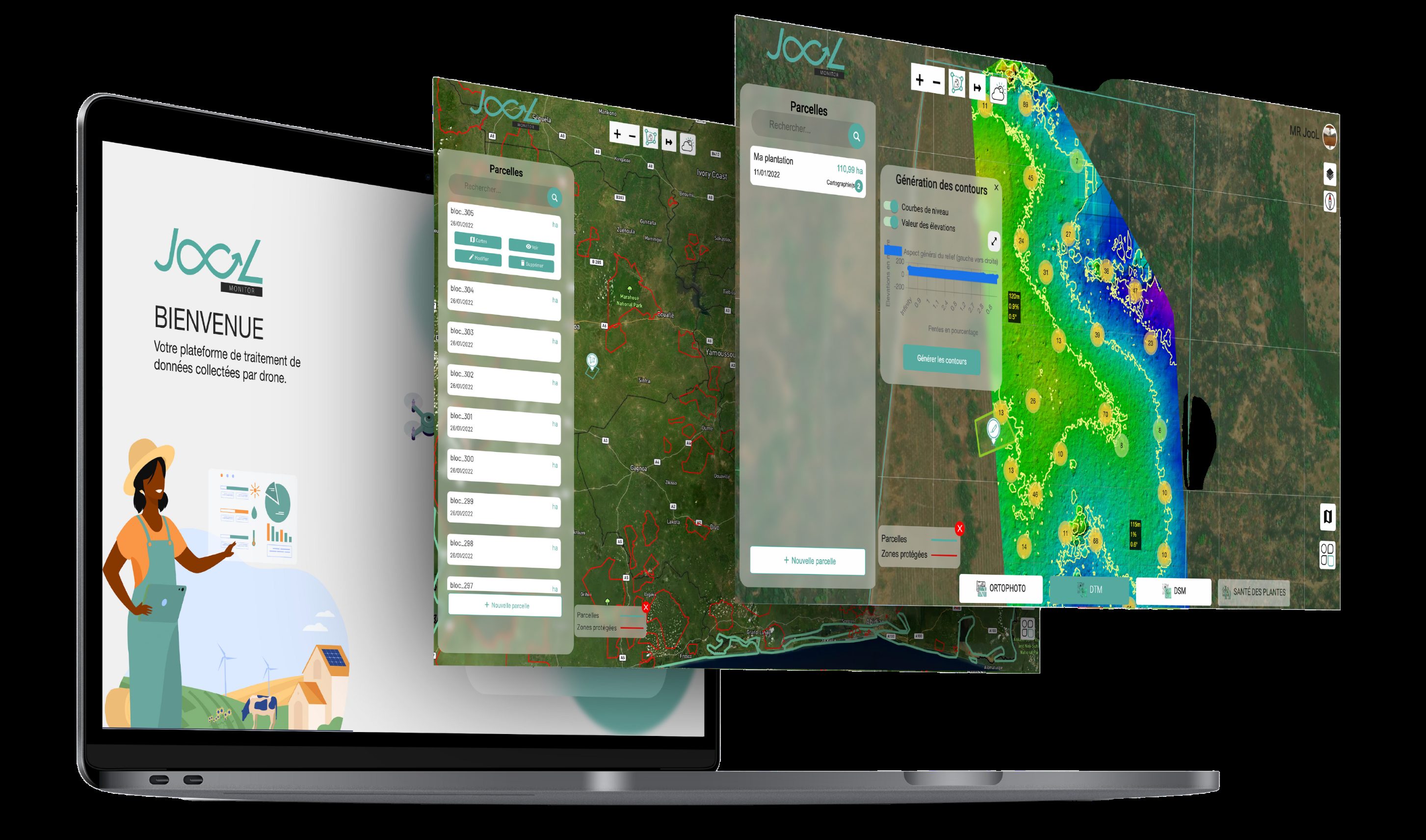
JooL Monitor transforms drone imagery into actionable field intelligence to count, measure, map and monitor your plots with field-ready detail.

01
Advanced mapping
Generate orthomosaics, 3D models and precise boundaries to visualise your land with field-level detail.
02
Smart counting & measurements
Measure surfaces, distances and densities, count trees, identify missing plants and analyse distribution across each plot.
03
Continuous visual monitoring
Compare plot evolution over time, track significant deviations and document the changes that truly matter.
JooL Monitor — drone mapping
place Palm block 4
report_problem 3 anomalies detected

Give a clear identity to
every farmer
and every field.

JooL ID structures essential agricultural data — farmers, plots, crops, surfaces, cooperatives and verification statuses — into a reliable, traceable and scalable infrastructure.

01
Farmer identification
Centralise farmer profiles with their key information, verification statuses and cooperative affiliations.
02
Farm mapping
Link each farmer to their plots, crops, surfaces and geographic data to create a clear operational view.
03
Agricultural programme management
Monitor cooperatives, certifications, subsidies, audits and agricultural projects through a structured and verifiable database.
👨🏾‍🌾
Kouamé Assi
Palm · 4.2 ha · Cowabo Cooperative
Verified
👩🏾‍🌾
Adjoua Koffi
Rubber · 7.8 ha · South Cooperative
Verified
👨🏿‍🌾
N'Guessan Yao
Cocoa · 2.6 ha · North Cooperative
Pending
👩🏾‍🌾
Fatou Diallo
Palm · 5.1 ha · West Cooperative
Verified
people
300 000
Registered farmers
610 000
hectares mapped

Turn recommendations
into field interventions.

Mon Agro by JooL connects JooL diagnostics to a network of agronomists and technicians to support farmers, execute interventions and monitor plots with precision.

01
AI-targeted interventions
Deploy the right actions in the right places using alerts and priority levels generated by KIRiQ AI.
02
Field team coordination
Assign missions, monitor interventions and manage operations through a centralised operational view.
03
Operational tracking & reporting
Field data flows back automatically to measure impact and manage operations continuously.
warning_amber
Rubber Block — South Zone
Water stress · Agronomist assigned
Urgent
flight
Drone spraying — Pineapple
18 ha · Mission in progress
In progress
check_circle
Foliar treatment — Adjoua K.
4.2 ha treated · Report submitted
Completed
250
Active agronomists
42
Missions / month
95%
Completion

Results that speak
for themselves.

The impact of our solutions in the field, in numbers.

+300 000
Digitalised farmers
+610 000
Area monitored
3
Crops covered
89%
AI accuracy

Agricultural data becomes a trusted infrastructure.

From insurers and agro-industrials to cooperatives and public institutions, JooL helps agricultural stakeholders see better, decide faster
and act more effectively in the field.

Apromac
PMCI
Sodexam
TRCI
Archetyp
Tony's Chocolonely
Palmci
Palmafrique
Veolia
Coris Assurance
SIM Assurance
SAPH
Emergim
Korigins
Carré d'Or
Mairie de Dioulatédougou

La solution rapide, fiable
et puissante pour l'agriculture.

speed

Résultats en 24h

Du vol drone au rapport final en moins de 24 heures. Des données exploitables dès le lendemain de l'acquisition.

hub

Écosystème intégré

KIRIQ AI, Jool Monitor et Jool ID communiquent entre eux. Une vision unifiée de toutes vos exploitations.

offline_bolt

Mode hors-ligne

Nos applications fonctionnent sans connexion. Idéal pour les zones rurales à connectivité limitée en Afrique.

verified_user

Données certifiées

Traçabilité complète et données conformes aux exigences des certifications internationales (RSPO, ISO, etc.).

insights

IA agronomique

Modèles d'IA entraînés spécifiquement sur les cultures tropicales africaines pour une précision maximale.

support_agent

Support dédié

Une équipe d'experts agronomes et techniques disponible pour vous accompagner à chaque étape.

Questions? Answers.

Everything you need to know about our AgriTech solutions.

Do I need an internet connection in the field to use your solutions? add
No. Our mobile applications work in offline mode. Data synchronises automatically as soon as a connection is available — ideal for rural areas with limited connectivity.
What is the difference between KIRiQ AI and JooL Monitor? add
KIRiQ AI analyses via satellite at scale (thousands of hectares) with regular frequency. JooL Monitor uses drones for centimetre-level precision on targeted areas. The two are complementary: KIRiQ detects anomalies, JooL Monitor confirms them precisely.
What types of crops are supported? add
Our solutions are optimised for oil palm, rubber, cocoa, coffee and major food crops. Our AI models can be adapted to other tropical crops on request.
How long does it take to receive results after a drone flight? add
JooL Monitor reports are delivered within 24 to 48 hours after the flight. For KIRiQ AI, satellite data is processed and available in near-real time depending on cloud cover.
Is JooL ID compatible with our existing systems? add
Yes. JooL ID has an open API allowing integration with your ERP, databases and existing management tools. Our technical team supports the integration process.
Where can I download the mobile applications? add
Our applications are available on the App Store (iOS) and Google Play (Android). Contact us to obtain your enterprise access and configuration tailored to your farm.
J
L

Transform your farm
today.

Join the agro-industrials and cooperatives that trust Jool International.

check_circle Your message has been sent! We will get back to you very soon.